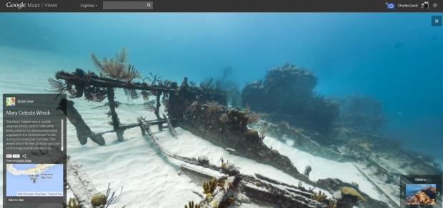
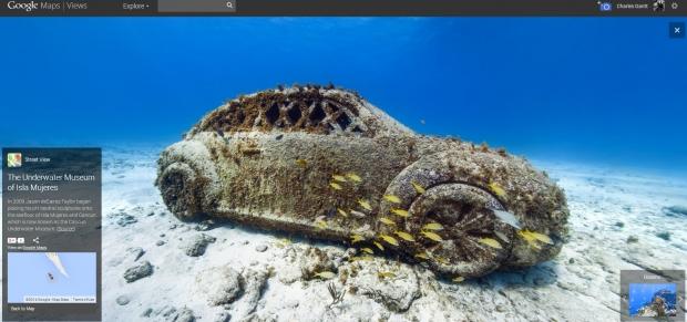
Google's Street View is one of the revolutionary products from the company that forever changed the way we navigate the world. With Google's recent expansion of Street View to locations beyond city streets, the service has become much more than a simple navigation too, and people are using it to take virtual vacations to remote places all over the world. Today Google rolled out more images for its Underwater Street View library, taking us to popular diving spots in Cancun, and Isla Mujeres.

These latest editions join a collection of underwater panoramic photos from hot spots such as the Great Barrier Reef, the Philippines, and Hawaii as well as spots from Bermuda Monoco, and the Galapagos Islands. Each photographic excursion takes place over a 2-3 kilometer area and is comprised of some 3000-4000 images that are later stitched together to form the breathtaking panoramic images seen in Street View.

For right now, Google seems to be focusing mainly on areas around North and South America, but the company says that in the future it will expand to the rest of the worlds underwater treasures, and that it expects to have a much larger uncatalogued within the next two years. Projects like this are one of the most important things Google does in my opinion as we know more about outer space than we do about the Earths Oceans. Personally, I hope Google teams up with someone like NOAA or Odyssey to do more panoramic images of deep water sunken ships and other ruins that lay below the waters surface.

